Languidd - Education through maps

Languidd combines abstract photography with interdisciplinary knowledge transfer and is probably the most exciting Instagram account this year. We're talking about glitches, deforestation, and the golf courses in the Tokyo metropolitan area.


As early as the 1950s, both the US and the Soviet Union launched satellites into space and it was the Cold War that advanced the development of satellite communication technology. A lot has happened since then, various scientific disciplines are no longer conceivable today without the artificial moons, as satellites were previously called - cartography, weather forecasts, astronomy, GPS, to name just a few functions, and our daily usage of these services make clear how strongly we are connected to the probes orbiting the earth.
To understand the satellite images we first have to classify them in terms of human history. Even before the development of image-transmitting satellites, there was the possibility to see the earth from above, with airplanes or weather balloons, but analogous to Juri Gagarin's flight into space and thus leaving our atmosphere, it has an effect on our self-image that we can only adumbrate.


Satellite images are also of great importance in climate research; by comparing recordings from different years, the melting of glaciers, for example on Greenland or in the Himalayas, the slow disappearance of the ice mass of the poles and the vanishing of the rainforest in the Amazon region, as long as it is that reliable Satellite images exist, it becomes more clearly visible than we could ever perceive from a human perspective.
At the beginning of this century, with the boom of the Internet and that of Google, the possibility of viewing Terra was largely democratized. The Google service Maps has been online since 2005 and Street View followed in 2007 and both enabled the possibility to virtually travel around the world and look up places from home. These tools have become an indispensable part of everyday life for many people in order to look up places in the area, to find restaurants and connections - or in the case of more than 50 million refugees worldwide to orientate.


Around 2010 artists began to use the images provided by Google and sparked a new debate about authorship and ownership on the one hand and established a new artistic practice on the other. A practice that is more about finding images than searching for them. Everyone now had the same conditions and is not tied to physical travel to the places of interest.
Jacqui Kenny suffers from agoraphobia, an anxiety disorder that makes the person feel unsafe in their environment, but that's no problem at all, she trawls through Google Street View and takes photos in Sudan and Peru from home, the very same morning, easy.


One of the names that keep appearing in connection with Google Street View is Jon Rafman, whose works exist in the tension between human experience and machine image capture in his ongoing project 9-eyes. His motifs are those of classic street photography, but also strange and absurd. His work shows sex workers in Italy, car accidents, a sandstorm threatening to overtake the car, children playing, scenes that happen naturally at the roadside, and what’s remarkable is the speed of the car that shines subversive though the taken images.
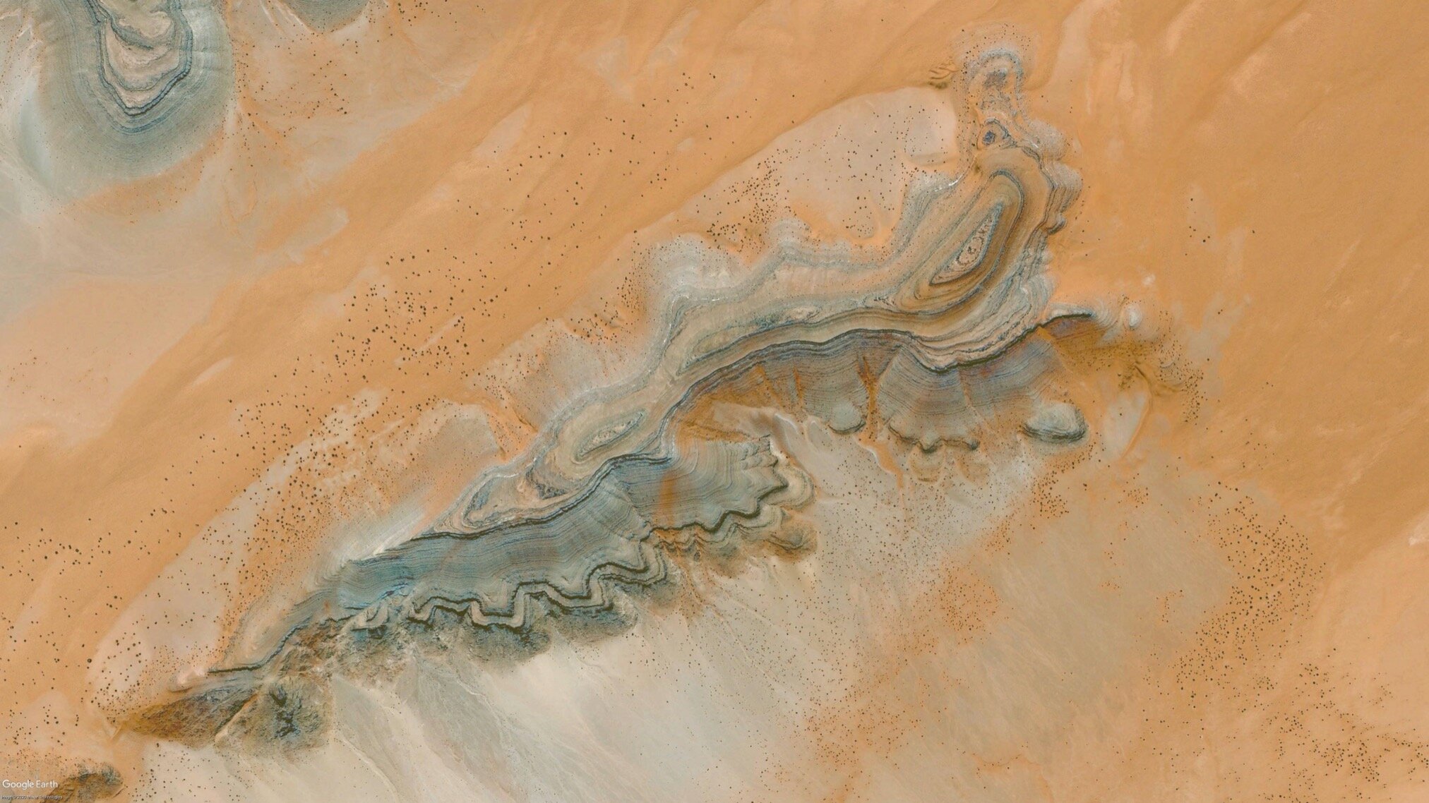
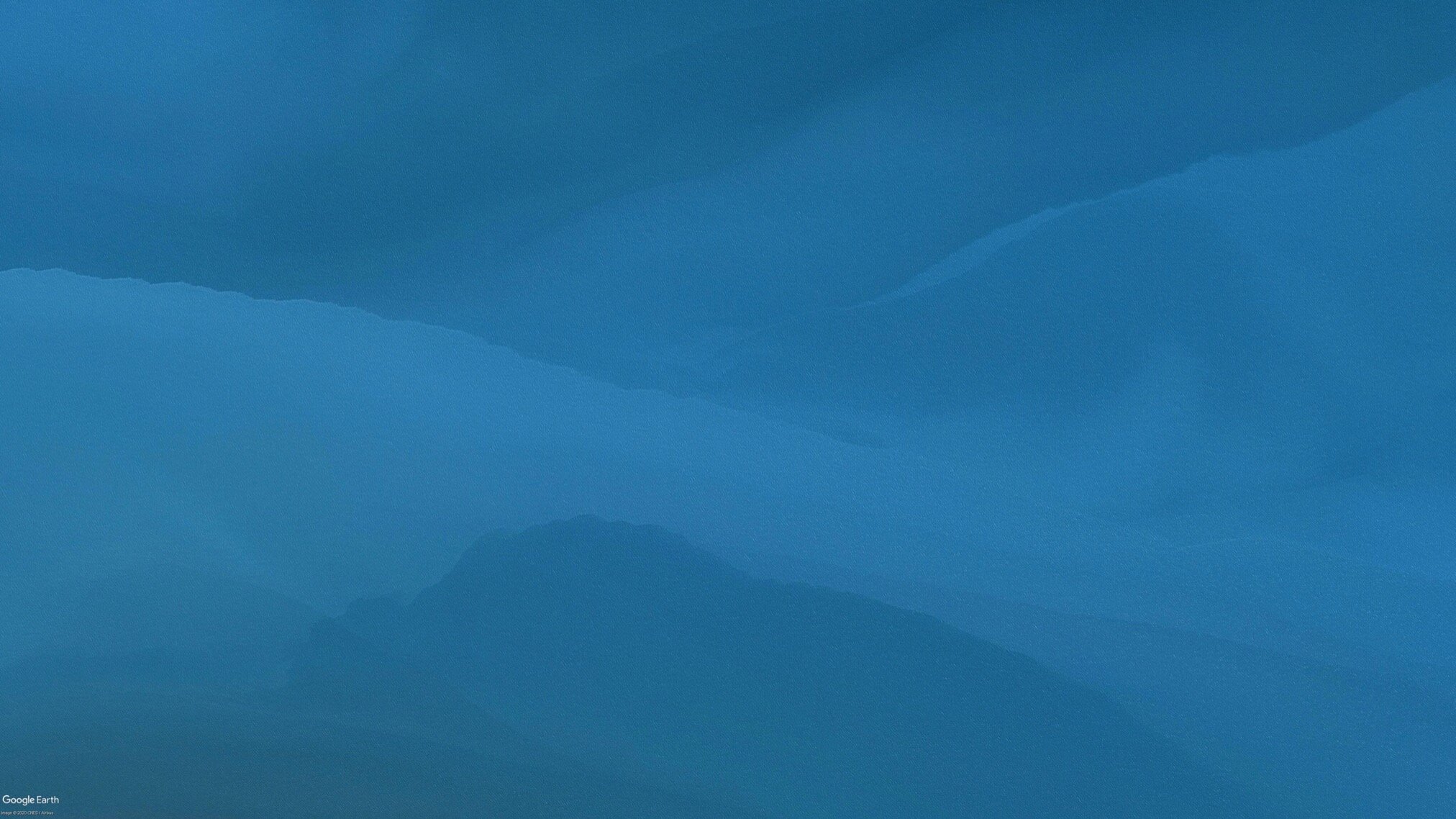
Where Rafman and Kenny are looking for scenes from real life, Languidd (your new favorite Instagram account) moves on to a more abstract level, he sees life and its history through the strangely geometric and organically flowing shapes that open up as soon as you look at our planet from above. The scale on which the events are described is different because both anthropological and geological scenarios need more time to develop than the real-time recordings we know from Google Street View.


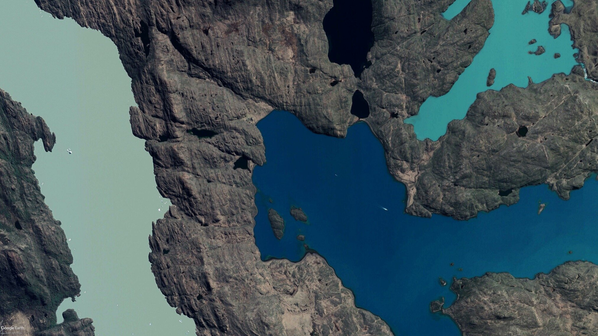
Languidd shows us motifs from all continents, landscapes through which we can walk and look at from the ground, but the distance created by looking from above enables a new understanding of the planet we live on.
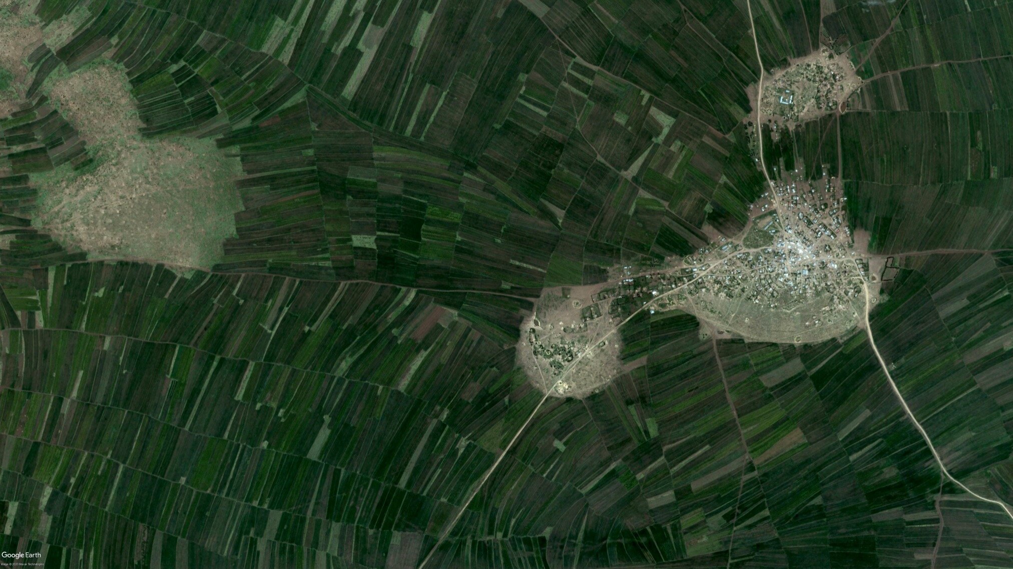
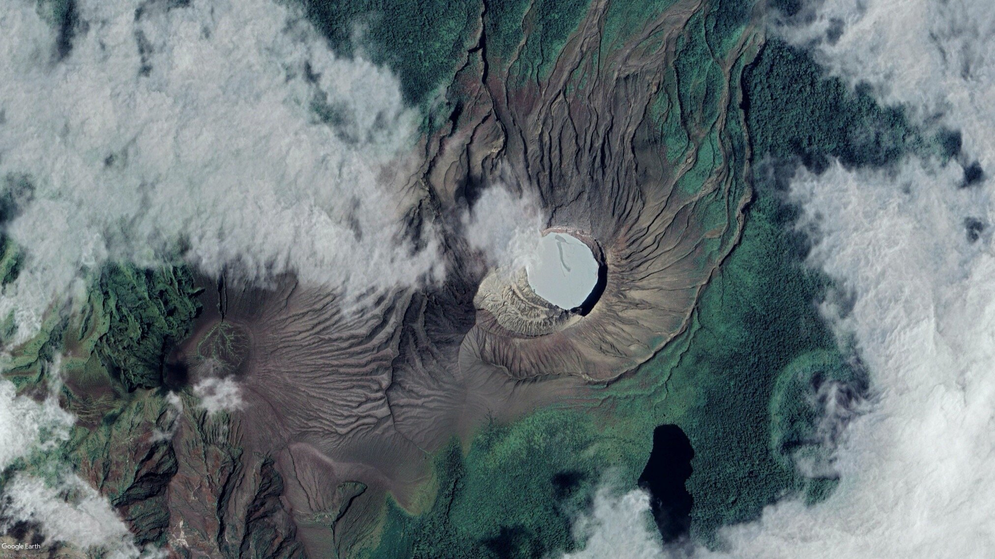
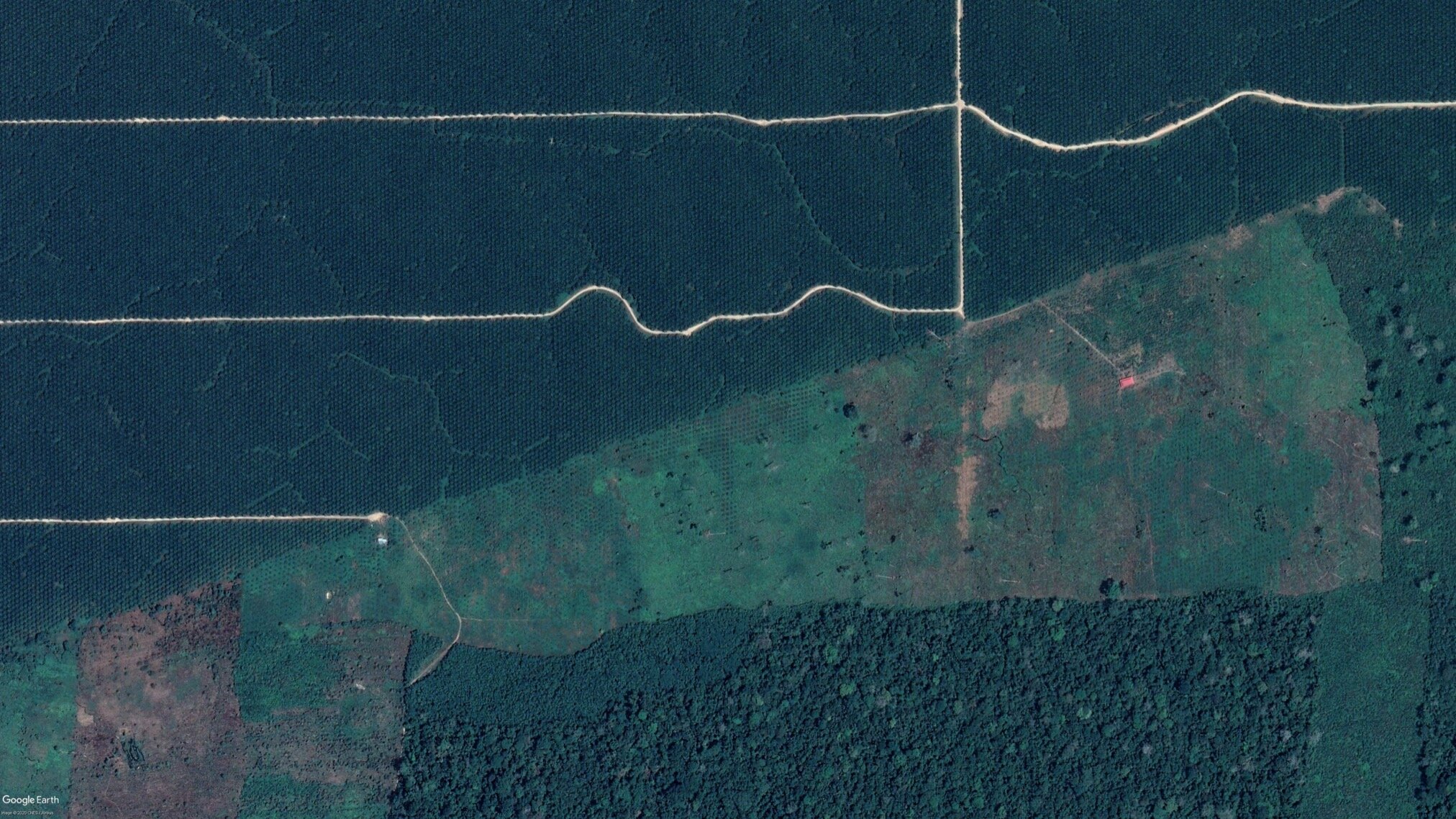
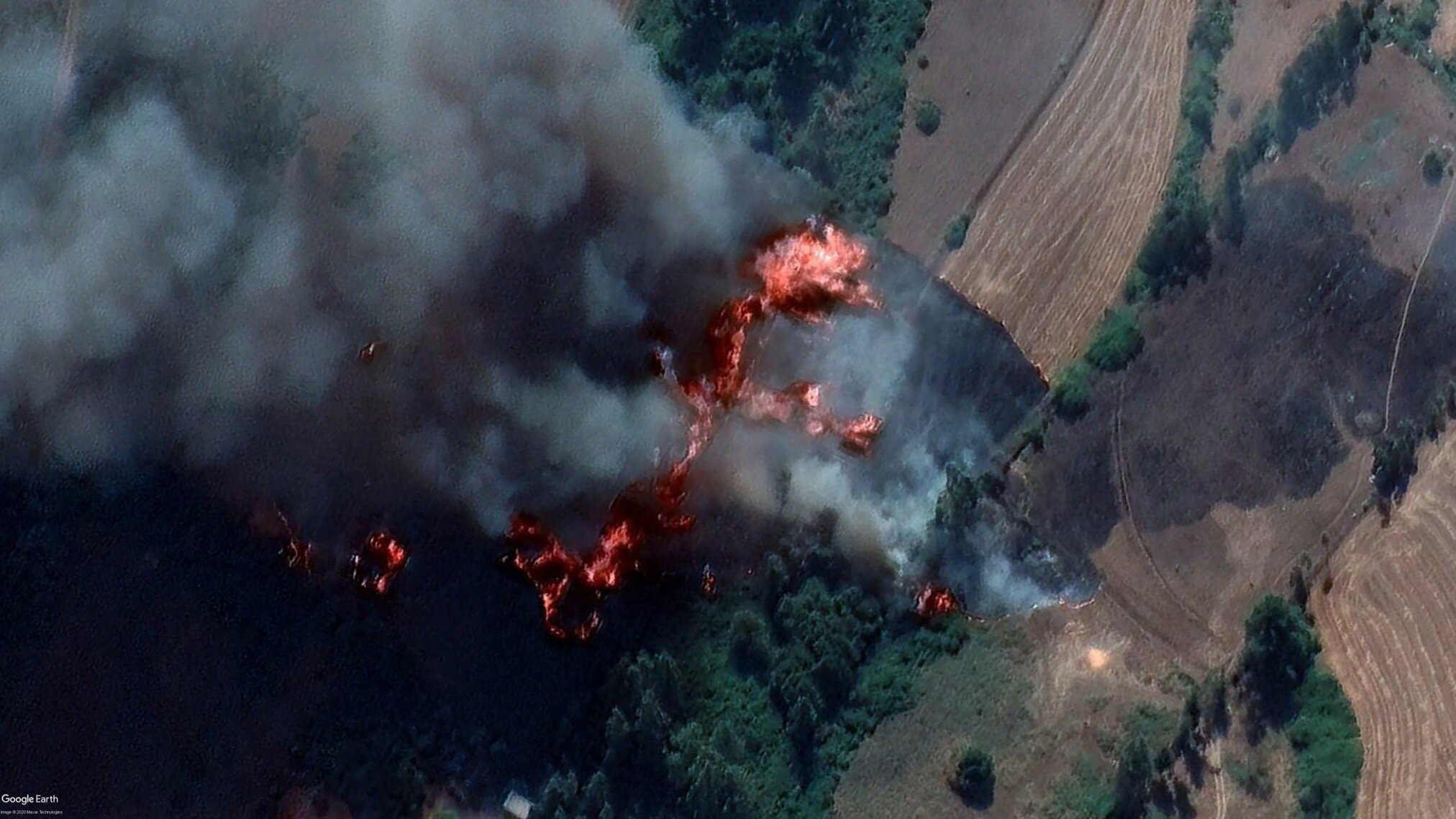
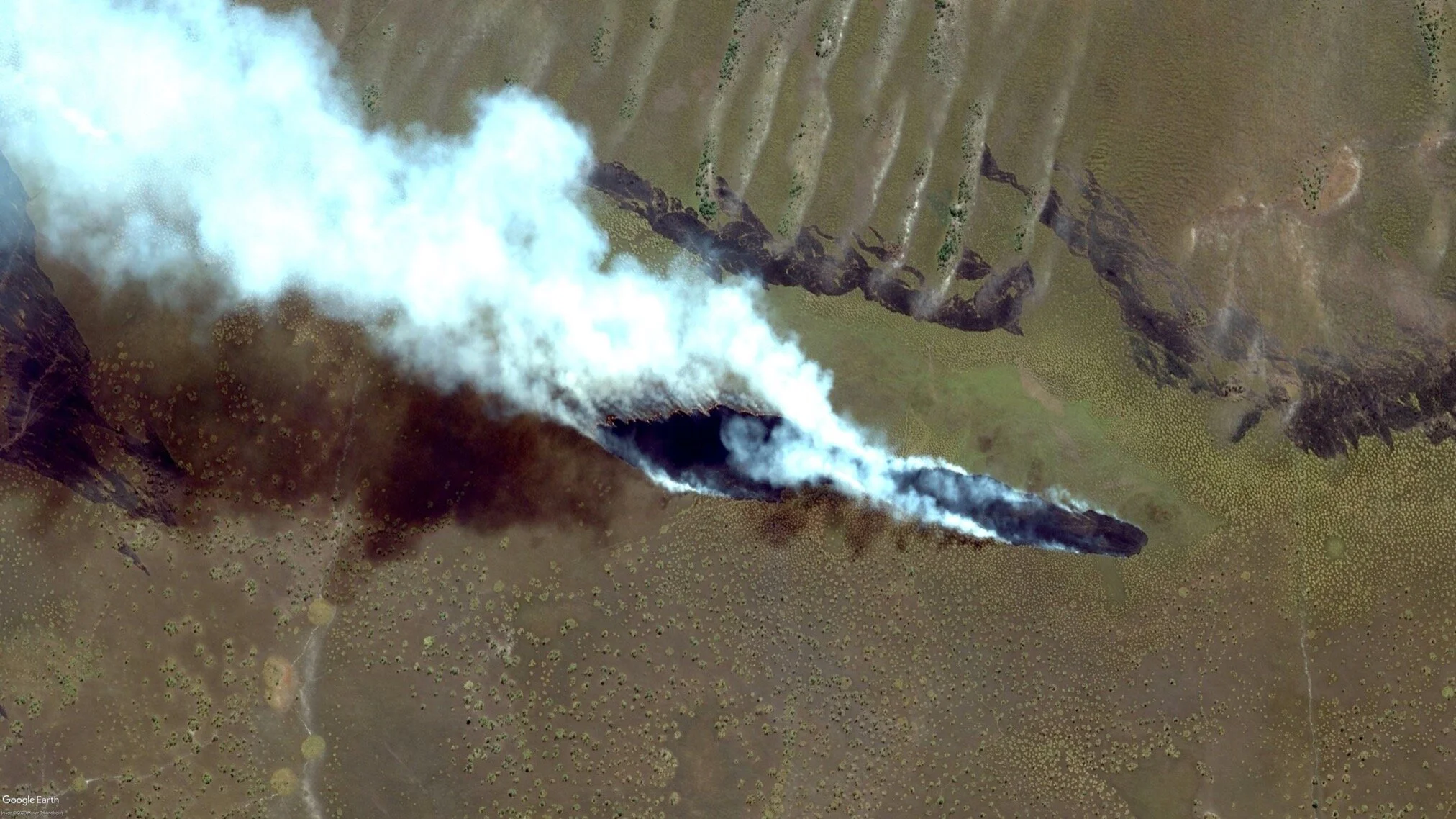
The map view enables Languidd to explain geographic processes such as the formation of volcanic landmass and the resulting flora and fauna in a playful, even effortless way. The look from above facilitates understanding what impact human life has on its environment. The visualization of the green areas in Europe resulting from centuries of deforestation or that of wet rice fields in China and the associated terraforming shows the extent of the human factor on the environment in an impressive way.


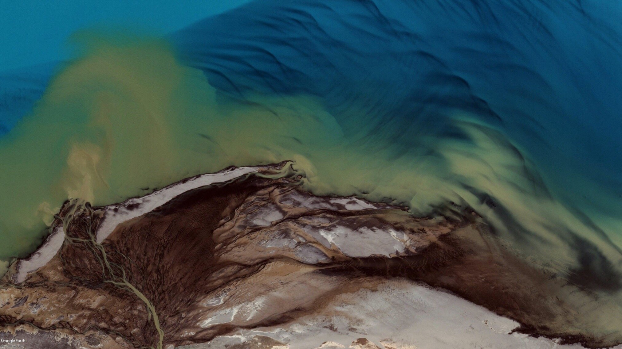
In addition to the informative posts, we also find satellite images on the profile that bristle with anomalies, they are composed of various individual images that were taken either under different lighting conditions or in different seasons, images of deserts that mystically sparkle or ice fields in which the light breaks. In addition, we find glitches in the footage, computer-generated shapes, and organic landmass merge into one image and it becomes clear once again how much the earth and the life on it, the organic and the electric, are intertwined.


Languidd’s aesthetic approach of perceiving nature in abstract forms and surreal colors gives us the opportunity to see ourselves in a different relation to the world around us and to understand ourselves as human beings for what we are, rather small from above.
Dear @languidd, first things first - who is the person behind the Instagram-account?
I'm a 19 year old architecture student from the Los Angeles metro area. I spend most of my time nowadays running, 3D modelling, and browsing Google Earth.


Can you tell us a little about the project and how you came across the idea?
Honestly, Languidd is just documentation of the things that I find when I'm using Google Earth. It's an obsession I've had for a while now. If I was bored during class or trying to fall asleep, I would open the app on my phone and start looking at places I wasn't familiar with. I think I've always been like that because I can remember all the way back to elementary school when I would spend more time looking at the map on the book than actually reading it. The only difference now is that I share what I find on Instagram.


How do you source your footage? Do you search the earth’s surface randomly or look up certain phenomena you find interesting that later translate into a mapped visualization?
If you pick a continent and look for long enough, you'll eventually find something pretty cool. I've actually learned a lot about what produces interesting landscapes, so if I'm not having much luck I'll just look for the nearest volcanic region and go from there. You start to see patterns after a while, but it never gets boring.


You connect your unique visual approach to abstract photography with educational content on a variety of subjects. Why did you choose Instagram and what are the benefits of using the App as an educational tool?
Instagram is a great platform for me because the main focus is on the images, but I can provide lots of information in the caption if I want to. There's no expectation for me to give an entire lecture on plate tectonics or crazy stuff like that in there, but I can if I want to. At the same time, I like leaving some things to the imagination because it can get people even more curious that way.


What did you learn from looking at all those maps and sourcing all the information, and what do you hope we can learn from it?
My biggest takeaway from all of the looking around is that the Earth is insanely diverse, and no matter how diverse you think it is, it’s more diverse than that. It is true that there are themes to agriculture, city development, and geography, but the variation across these themes is so extreme that it can be hard to even comprehend that what you’re looking at might be someone's homeland. I hope the people who see my page come to understand that they live in a world that should be protected for future generations. I want to draw attention to the places that are disappearing, because once they’re gone, there’s nothing to guarantee they’re coming back.


What was the weirdest thing you discovered so far?
Japan has over 2500 golf courses, which is more than California and Florida combined. I remember seeing a golf course in Tokyo and thinking it felt out of place in such a dense urban neighborhood. But then as I kept looking, I realized that the Tokyo metropolitan area is basically surrounded on all sides by innumerable golf courses, many of which run over a mile lengthwise. It was a really surreal thing to take in at first, and it still doesn't make much sense to me.


Within your postings, there are some recurring themes. One is the human agricultural impact and transformation of the land. Do you think looking from above can create a different type of sensibility or awareness in terms of how we are handling the planet?
It absolutely can. Deforestation is easily the most visually striking representation of our impact on the environment. One especially potent example of this is Mt. Taranaki in New Zealand, which has a perfect circle of government protected forest around it, contrasted against the comparatively barren farmland that was slashed and burned out of the old growth when the island was colonized. When you see that lonely green circle and realize the entire island used to look like that, it’s pretty eye-opening.


There’s quite a big community of map-lovers and Google Earth and Street View enthusiasts out there. People dealing with everything from programming bots that post random places to playing GeoGuessr, a Google Maps-based game, that makes you guess locations based on street view images. How does your practice fit in this community?
I actually used to play GeoGuessr during class when I was bored, but I never connected it to Google Earth as I see it now. I’ve never seen myself as a part of any kind of Google Earth community, and I engage a lot more with fashion and art communities than anything else. I think they encourage me to focus more on the abstract, textural aspects of the planet, which has been a really fun way to look at the project.


What is your favorite place to roam around from above?
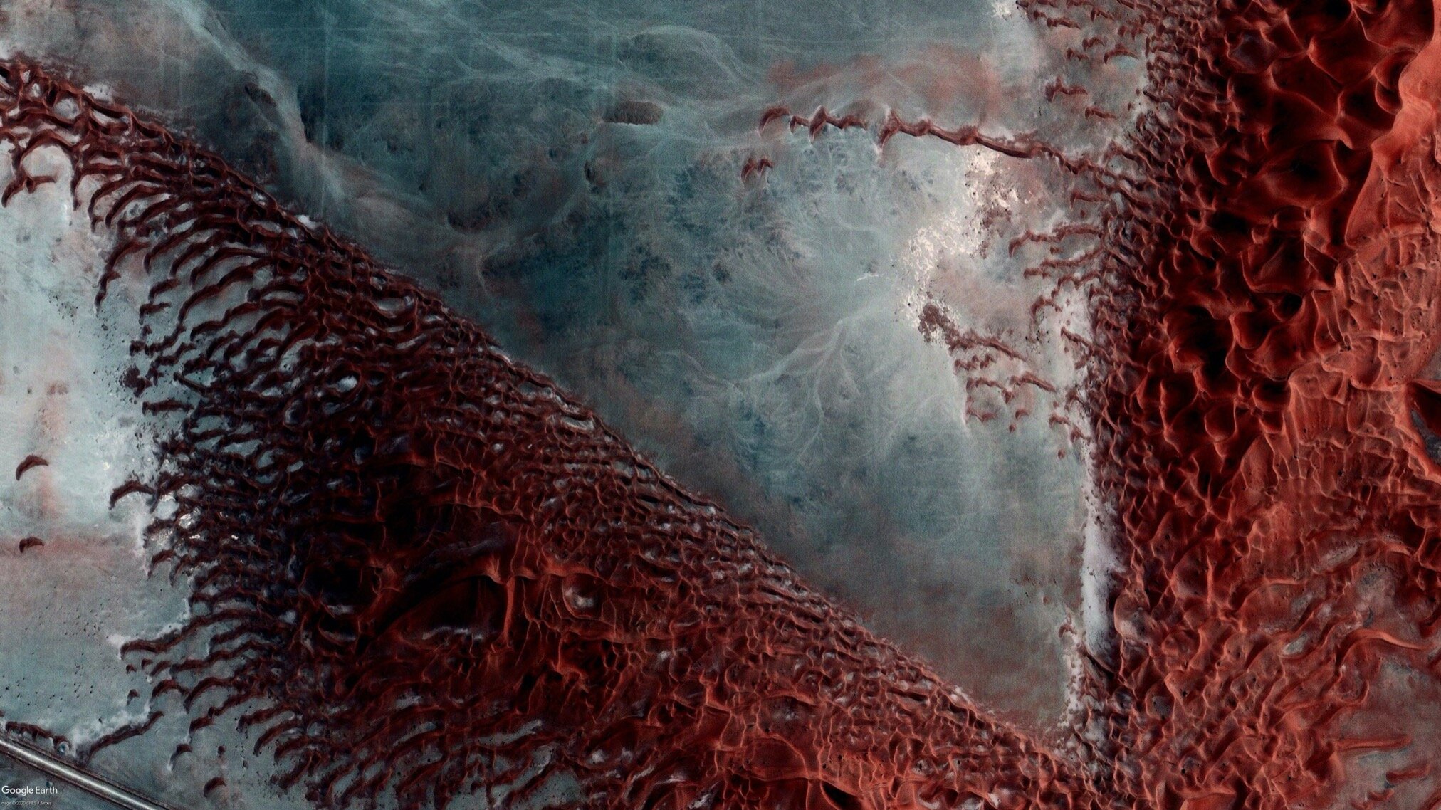
I could probably run an entire second account just off of endorheic basins and salt flats. Australia has an abundance of them, and the combination of hyper-saline ecosystems, high rates of evaporation, stagnant water, and reflective surfaces often makes for a glitched-out, psychedelic composition that you really can’t find anywhere else. They’re like blank canvases specially designed for aerial imagery to gloriously fail on- when they’re dry they’re horribly overexposed, when they’re inundated they throw off the color balance, when they've just dried up they leave behind intricate patterns, and the best part is that you get to see all of these things at the same time because they’re rarely captured all at once so you have a quilt of different seasons and conditions stitched together to make one beautiful panoramic mess.


There is a gap in the coverage of satellite imagery between the western world and the global south which shows in the image resolution and the labelling of the infrastructure. How do you go around that?
Thankfully the coverage of the Earth is getting better every year, and as of 2020 the only place where I know the resolution and quality of imagery isn’t high enough for a phone screen is equatorial Africa, and even then there’s parts of it that are steadily improving. The main technological issue I face is actually images that get taken at different times, which can happen anywhere.


Looking at your work from an abstract photography angle you make usage of glitches, anomalies, and other sources of friction such as clouds to create your compositions. What was your initial interest in using those images that are less useful for the eye of the common viewer?
Random artifacts and inconsistencies are actually super annoying to deal with on a daily basis. There's plenty of posts that didn’t happen because an imagery stitch ran right down the middle of something, which in my opinion looks sloppy in most cases. So when something goes wrong to an extreme degree and it accidentally looks cool, it’s kind of like my revenge for all the times I had to give up on something that would have been spectacular.


What would you like to explore in the future?
I think I’ll start using other methods of aerial imagery like USGS Earth Explorer and LandViewer. They can have ridiculously high resolution and up to date imagery, which could be useful for doing new kinds of posts like now/then comparisons. I’d also love to maybe come in contact with companies like Maxar, who have satellite imagery accounts of their own which are straight from a high power satellite, but with all due respect can often lack ambition in choice of subject.
Thank you for your time!
Credits:
Images: courtesy of Google Maps
Screenshots taken by Languidd
About the author:
Juri Marian Gross is a photographer and writer based in Leipzig, Germany. His work focuses on sustainability and environmentalism within fashion and arts.